
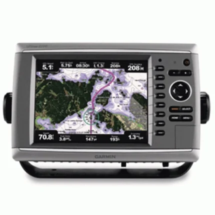
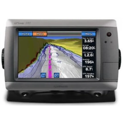
Garmin GPSMAP 4010 Network Chartplotter
$809.00
Garmin GPSMAP 4010 Network Chartplotter is a Garmin helm display focused on charting, network sharing, and add-on sensor integration. It supports satellite-enhanced basemap viewing, BlueChart g2 Vision expansion, NMEA 2000 data sharing, and live video input.
Overview Garmin GPSMAP 4010 Network Chartplotter
Garmin GPSMAP 4010 Network Chartplotter is configured for users who want the 4010 platform specifically as part of a wider Garmin Marine Network. It uses a worldwide basemap enhanced with satellite imagery and can be expanded with BlueChart g2 Vision data for aerial reference photography, 3D views and Auto Guidance features.
Because the unit is designed to communicate with additional displays and remote sensors, it is suited to helms that want shared navigation data across multiple screens. Video input and NMEA 2000 support also make it practical for broader helm integration beyond chart display alone.
Key Features
- Network-first role: The display is positioned as a central hub for Garmin Marine Network installations with multiple connected devices.
- Satellite-enhanced chart view: The worldwide basemap is supported by optional g2 Vision data for more detailed navigation context.
- Shared helm information: The unit can exchange information with compatible chartplotters and remote sensors on the network.
- Video input support: Onboard cameras can be connected for monitoring engine spaces or other parts of the vessel.
- System expansion: Compatible radar, sonar and XM weather or radio features can be added as the helm grows.
- NMEA 2000 integration: The plotter supports broader data sharing with compatible marine electronics.
Applications
- Garmin helms that rely on shared chart and sensor information across multiple displays.
- Networked installations adding radar, sonar or weather modules over time.
- Boats that want one screen to handle charting and selected camera monitoring.
Specifications
| Basemap | Worldwide basemap with high-quality satellite imagery |
| Chart expansion | Optional BlueChart g2 Vision via SD card slot |
| Networking | Garmin Marine Network support |
| Video | Video input for live onboard monitoring |
| Data interface | NMEA 2000 connectivity |
| Included GPS hardware | Includes GPS 17x NMEA 2000 receiver |
| Package focus | Supplied with network installation accessories and covers |
What’s Included
- GPSMAP 4010
- GPS 17x NMEA 2000
- Bail mount and knobs
- Protective front cover
- Top and bottom snap covers
- Video cable assembly
- Power cable assembly
- NMEA 0183 cable
- NMEA 2000 drop cable
- NMEA 2000 10 m backbone cable
- NMEA 2000 power cable
- NMEA 2000 T-connector & terminator kit
- Flush mount hardware
- Flush mount gasket
- Marine grommet kit
- Owner’s manual on disk
- Quick reference guide
- Installation instructions


Reviews
There are no reviews yet.