
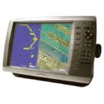
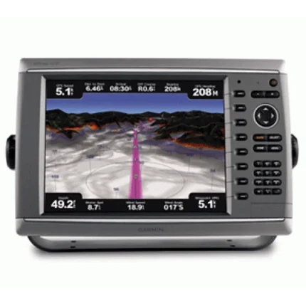
Garmin GPSMAP 4210 Network Chartplotter
$828.00
Garmin GPSMAP 4210 Network Chartplotter is a big-screen Garmin chartplotter built for networked navigation and detailed coastal mapping. It supports BlueChart g2 Vision expansion, NMEA 2000 integration, and bundled GPS 17x accessories for broader helm connectivity.
Overview Garmin GPSMAP 4210 Network Chartplotter
Garmin GPSMAP 4210 Network Chartplotter is intended for boaters who want a larger Garmin charting platform with room to expand into a broader helm system. The unit is positioned as a big-screen network chartplotter and comes with detailed coastal mapping support for practical day-to-day navigation.
Its charting can be expanded with optional BlueChart g2 Vision data for satellite overlays, aerial photography, 3D views and Auto Guidance. NMEA 2000 compatibility and the included GPS 17x NMEA 2000 receiver help make it suitable for installations that need charting integrated with other marine electronics.
Key Features
- Big-screen charting role: The unit is designed as a larger chartplotter for helms that need easier chart interpretation and route management.
- BlueChart g2 Vision support: Optional chart cards add satellite imagery, aerial reference photos, 3D views and route-planning enhancements.
- Detailed marine data: Fishing charts, tides, currents, coastal roads and points of interest expand the usefulness of the display on unfamiliar water.
- NMEA 2000 compatibility: The unit can integrate with compatible marine electronics in broader helm networks.
- Network-ready package: Included GPS 17x NMEA 2000 hardware supports installation in Garmin network environments.
- Comprehensive in-box kit: The supplied cables, covers and NMEA 2000 accessories support a more complete installation workflow.
Applications
- Networked helm upgrades that need a larger dedicated Garmin chartplotter.
- Coastal navigation where optional aerial imagery and 3D chart views are useful in unfamiliar harbors.
- Garmin installations that already rely on NMEA 2000 data sharing.
Specifications
| Chart capability | Detailed coastal mapping with optional BlueChart g2 Vision expansion |
| Vision features | Satellite imagery, aerial photography, Mariner's Eye, Fish Eye and Auto Guidance |
| GPS hardware | Includes GPS 17x NMEA 2000 receiver |
| Networking | NMEA 2000 compatible |
| Included interfaces | Includes NMEA 0183 and NMEA 2000 installation accessories |
| Package focus | Bundled as a network-capable big-screen chartplotter kit |
What’s Included
- GPSMAP 4210
- GPS 17x NMEA 2000
- Bail mount and knobs
- Protective front cover
- Top and bottom snap covers
- Video cable assembly
- Power cable assembly
- NMEA 0183 cable
- NMEA 2000 drop cable
- NMEA 2000 10 m backbone cable
- NMEA 2000 power cable
- NMEA 2000 T-connector & terminator kit
- Flush mount hardware
- Flush mount gasket
- Marine grommet kit
- Owner’s manual on disk
- Quick reference guide
- Installation instructions
Reviews
There are no reviews yet.