


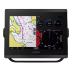
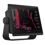
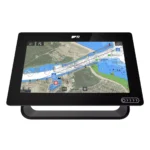
Garmin GPSMAP 8610 Chartplotter
$1,513.00
Garmin GPSMAP 8610 Chartplotter is a chartplotter built for integrated helm use, combining 10.0 inches Diagonal IPS, Full HD 1920 x 1080 pixels, Premium Performance (Fast Map Drawing), and NMEA 2000, Garmin Marine Network, Wi-Fi, ANT for navigation, chart control, and connected onboard systems.
Overview Garmin GPSMAP 8610 Chartplotter
Garmin GPSMAP 8610 Chartplotter is a chartplotter built for navigation, chart management, and integration with compatible onboard electronics. Key specifications include 10.0 inches Diagonal IPS, Full HD 1920 x 1080 pixels, Premium Performance (Fast Map Drawing), and NMEA 2000, Garmin Marine Network, Wi-Fi, ANT.
It is well suited to sailing and cruising, center consoles, and coastal operation where captains need a responsive display for route planning, split-screen viewing, and connected sensors. Features such as Full HD IPS Touchscreen Display and Preloaded Garmin Navionics+ Charts help support visibility, system control, and everyday helm operation.
Key Features
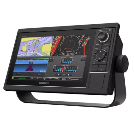
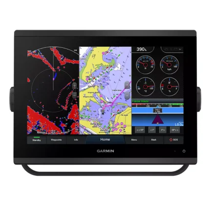
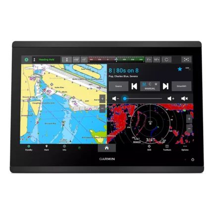
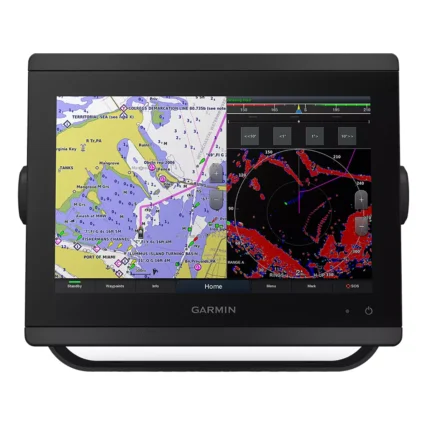
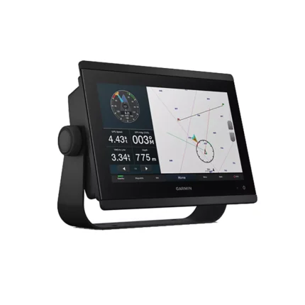
- Full HD IPS Touchscreen Display: The 10-inch premium screen delivers 1920 x 1080 resolution with anti-glare technology. The IPS panel ensures that colors stay true and data remains sharp from any angle, providing the visual experience for high-stakes navigation.
- Preloaded Garmin Navionics+ Charts: Navigate with confidence using integrated coastal and inland mapping. This includes Auto Guidance+ technology to help plan routes through complex channels, along with support for optional premium Garmin Navionics Vision+ content for relief shading and satellite imagery.
- SmartMode Station Controls: Minimize stress during high-pressure situations like docking or anchoring. SmartMode allows you to create one-touch presets that instantly configure all networked displays to the specific information you need for your current activity.
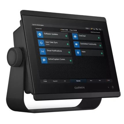
- OneHelm Digital System Integration: Take full control of your boat’s third-party systems. OneHelm allows the Garmin GPSMAP 8610 to communicate with compatible digital switching, lighting, and stabilization systems, consolidating your vessel's controls into one centralized touchscreen.
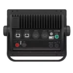
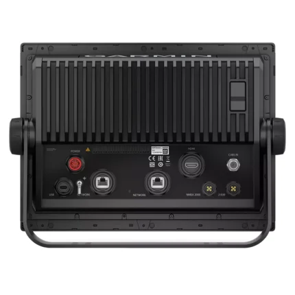
- Garmin Marine Network & NMEA 2000: Build a comprehensive electronics suite with ease. Seamlessly share sonar, radar, autopilot, and camera data across multiple screens.
Applications
Garmin GPSMAP 8610 Chartplotter is suitable for use on sailing and cruising, center consoles, and coastal operation where a central display is needed for charts, route planning, and connected onboard data. Its 10.0 inches Diagonal IPS screen and NMEA 2000, Garmin Marine Network, Wi-Fi, ANT support day-to-day navigation together with radar, sonar, video, or NMEA network integration where applicable.
It also fits refit and upgrade projects where captains want a cleaner helm layout without giving up system visibility. Features such as Full HD IPS Touchscreen Display and Preloaded Garmin Navionics+ Charts help keep chart data and connected functions accessible during coastal passages, offshore runs, and routine maneuvering.
Specifications
| Display Size | 10.0 inches Diagonal IPS |
| Resolution | Full HD 1920 x 1080 pixels |
| Touchscreen | Yes (Multi-touch) |
| Processor | Premium Performance (Fast Map Drawing) |
| Mapping | Preloaded Garmin Navionics+ |
| GPS Receiver | 10 Hz Internal GPS/GLONASS/Galileo |
| Networking | NMEA 2000, Garmin Marine Network, Wi-Fi, ANT |
| Engine Integration | Mercury SmartCraft Connect Compatible |
| Waterproof Rating | IPX7 Standards |
| Product Warranty | Limited Manufacturer Warranty Included |
What’s Included
- 1x Garmin GPSMAP 8610 Chartplotter Display
- 1x Preloaded Garmin Navionics+ Charts (US and Canada)
- 1x Power Cable and NMEA 2000 Drop Cable (2m)
- 1x NMEA 2000 T-connector
- 1x Bail Mount Kit with Knobs
- 1x Flush Mount Kit
- 1x Protective Cover and Trim Piece Snap Covers
- 1x Comprehensive Documentation Pack
Related products

Reviews
There are no reviews yet.