
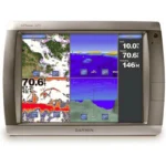
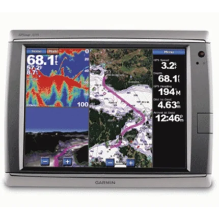
Garmin GPSMAP 5208 Touchscreen Chartplotter
$963.00
Garmin GPSMAP 5208 Touchscreen Chartplotter is an 8.4-inch Garmin chartplotter built for networked navigation and touchscreen operation. It combines BlueChart g2 coastal mapping, Garmin Marine Network expansion, WAAS-enabled GPS, and video support in a flush-mount-friendly format.
Overview Garmin GPSMAP 5208 Touchscreen Chartplotter
Garmin GPSMAP 5208 Touchscreen Chartplotter is built as an 8.4-inch touchscreen navigation display for Garmin Marine Network installations. The VGA screen, streamlined flush-mount look and touch-driven interface make it a practical fit for helms that want chart-focused operation without moving to a larger display.
It comes preloaded with BlueChart g2 coastal U.S. cartography, Bahamas Explorer coverage and a WAAS-enabled GPS 17 antenna package. Optional radar, sounder, XM weather and BlueChart g2 Vision support make the unit suitable for broader networked navigation systems that also need video input and detailed route-planning tools.
Key Features
- 8.4-inch touchscreen display: The VGA screen provides video-quality chart viewing in a size that fits a wider range of helms.
- Preloaded coastal cartography: BlueChart g2 coverage for the coastal U.S. and Bahamas supports immediate navigation use.
- Network-ready platform: Three built-in network ports help connect compatible Garmin radar, sounder and other MFD equipment.
- Expanded chart detail: Optional g2 Vision cards add satellite imagery, aerial photos, 3D views and Auto Guidance.
- Broader data integration: NMEA 2000 and NMEA 0183 support allow the plotter to work with AIS, DSC and other system inputs.
- Touchscreen plus video support: Two video inputs and a touch interface allow the unit to handle both navigation and onboard monitoring duties.
Applications
- Touchscreen chartplotter duty on coastal helms using Garmin networking.
- Installations that want radar, sonar, weather and camera feeds on a mid-size charting display.
- Boats that prefer a flush-mounted touch unit with BlueChart g2 coverage ready to use.
Specifications
| Display | 8.4-inch VGA touchscreen display |
| Chart data | BlueChart g2 coastal U.S. coverage including Alaska, Hawaii and the Bahamas; Explorer charts covering the Bahamas |
| GPS | WAAS-enabled 12 parallel channel GPS sensor with included GPS 17 antenna |
| Networking | 3 built-in network ports |
| Video | 2 video inputs |
| Data interfaces | NMEA 2000; 4 NMEA 0183 inputs and 2 NMEA 0183 outputs |
| Storage | Single SD memory card slot |
| Water rating | IPX7 |
What’s Included
- GPSMAP 5208
- Bail mount and knobs
- GPS 17 antenna (can be flush mounted or pole mounted)
- Protective front cover
- Power cable
- Video cable
- NMEA 0183 cable
- NMEA 2000 cable
- Flush mount hardware
- In-line fuse kit for GPS 17
- Marine grommet kit
- Crimp connectors
- Owner’s manual
- Installation instructions
- Quick reference guide
Reviews
There are no reviews yet.