
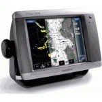
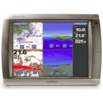
Garmin GPSMAP 5012 Touchscreen Chartplotter
$1,529.00
Garmin GPSMAP 5012 Touchscreen Chartplotter offers a 12.1-inch XVGA display, WAAS GPS, and Garmin Marine Network support for radar, sonar, cameras, and weather integration.
Overview Garmin GPSMAP 5012 Touchscreen Chartplotter
Garmin GPSMAP 5012 Touchscreen Chartplotter is a large-format network chartplotter built for helm stations that need more screen area and full Garmin system expansion. The 12.1-inch XVGA display is paired with WAAS GPS and a streamlined touch interface for charting, weather, and connected marine electronics.
It can be used as a standalone chartplotter with chart data or as part of a broader Garmin Marine Network. Optional BlueChart g2 Vision cards add 3D mapping, aerial reference photos, and Auto Guidance for more advanced route planning and harbor awareness.
Key Features
- 12.1-inch XVGA display: Large screen size makes it easier to work with charts and network data from the helm.
- WAAS-enabled GPS sensor: Supports reliable chart position and route tracking.
- Garmin Marine Network expansion: Connect radar, GSD 22 sounder, weather receiver, or additional multifunction displays.
- Video input support: Two video inputs allow compatible onboard camera feeds to be shown on screen.
- BlueChart g2 Vision ready: Optional cards add aerial photos, satellite imagery, 3D views, and Auto Guidance.
Applications
A strong choice for larger cruising and fishing boats that benefit from a big-screen chartplotter at the helm. The display size is useful when route monitoring, sensor integration, and weather overlays need to be viewed together.
It also suits Garmin network installations that need one primary charting display with room for radar, sonar, and video expansion.
Specifications
| Product type | Touchscreen network chartplotter |
| Display | 12.1-inch XVGA screen |
| GPS | WAAS-enabled 12 parallel channel GPS sensor |
| Video support | Two video inputs |
| Network support | Garmin Marine Network with radar, sonar, weather, and MFD connectivity |
| Interfaces | NMEA 0183 and NMEA 2000 |
What’s Included
- GPSMAP 5012 unit
- Bail mount and knobs
- GPS 17 antenna
- Protective front cover
- Power cable
- Video cable
- NMEA 0183 cable
- NMEA 2000 cable
- Flush mount hardware
- In-line fuse kit for GPS 17
- Marine grommet kit
- Crimp connectors
- Owner’s manual
- Installation instructions
- Quick reference guide
Frequently Asked Questions About Garmin GPSMAP 5012 Touchscreen Chartplotter
What is the Garmin GPSMAP 5012 Touchscreen Chartplotter designed for?
Garmin GPSMAP 5012 Touchscreen Chartplotter is built to serve as a dedicated chartplotter for everyday helm navigation. With its 12.1-inch VGA display, preloaded BlueChart g2 cartography, and stated performance features, it is positioned for chart handling, route work, and practical use within a connected marine setup.
How does the touchscreen help at the helm?
The 12.1-inch VGA display gives this chartplotter a clear working area for charts and menu control at the helm. Its touchscreen layout keeps route changes more direct, while the processing platform is described to keep chart browsing and menu response responsive at the helm.
Can this display work as part of a wider helm system?
This chartplotter is intended to work within a broader electronics layout by supporting Garmin Marine Network, NMEA 2000, and NMEA 0183, camera input support, and radar connectivity where stated. This gives the display a stronger role as a central charting screen when other sensors or onboard data also need to be viewed at the helm.
Who is this display most relevant for?
This chartplotter is most relevant for helm stations who need a dependable navigation screen at the helm. Its preloaded BlueChart g2 cartography also helps reduce setup time for boats that want charting ready from the start.
Related products
Garmin GPSMAP 1022 Chartplotter
$909.00
Garmin GPSMAP 1223 Chartplotter
$1,884.00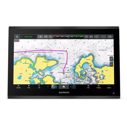
Garmin GPSMAP 9019 Chartplotter
$7,143.00
Garmin GPSMAP 9219 Chartplotter
$6,629.00
Garmin GPSMAP 9224 Chartplotter
$8,904.00
Raymarine Axiom+ 7 Chartplotter
$475.00
Reviews
There are no reviews yet.