

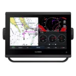
Garmin GPSMAP 923 Chartplotter
$974.00
Garmin GPSMAP 923 Chartplotter is a non-sonar 9-inch chartplotter built for fast navigation and clean helm integration, combining 9-inch display with 1280 x 720 pixels (WXGA), faster chart redraw and menu response, Garmin Marine Network support.
Overview Garmin GPSMAP 923 Chartplotter
Garmin GPSMAP 923 Chartplotter is a non-sonar chartplotter built for mariners who need fast chart handling, clear screen visibility, and reliable system integration at the helm. It combines 9-inch, 1280 x 720 pixels (WXGA), approximately 2x processing power over the previous generation, with support for NMEA 2000, NMEA 0183, Garmin Marine Network.
The Garmin GPSMAP 923 serves as a dedicated navigation station for cruisers and sailors who prioritize mapping and vessel control over dedicated sonar hardware. Because this is the non-sonar version, it is an ideal choice for secondary helm stations or for vessels that already utilize a dedicated black-box sonar module or network-shared sonar from a primary unit.
Key Features
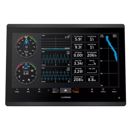
- Display and visibility: 9-inch, 1280 x 720 pixels (WXGA). This supports clear chart viewing and better readability at the helm.
- Processing platform: approximately 2x processing power over the previous generation. It helps keep menu response, chart redraws, and split-screen operation smooth.
- User interface: Edge-to-Edge Glass Touchscreen. This gives the operator direct access to navigation functions and connected system control from the main screen.
- Networking and integration: NMEA 2000, NMEA 0183, Garmin Marine Network. Compatible networking helps the unit share charts, radar, sensors, cameras, and other onboard data where supported.
- Position data: High-Sensitivity Internal 10 Hz. This supports accurate vessel positioning and update speed for navigation tasks.
- System expansion: J1939 Connectivity (Yamaha Compatible). This is useful when the display is part of a broader helm installation with engine or digital-switching integration.
Applications
The Garmin GPSMAP 923 serves as a dedicated navigation station for cruisers and sailors who prioritize mapping and vessel control over dedicated sonar hardware. Because this is the non-sonar version, it is an ideal choice for secondary helm stations or for vessels that already utilize a dedicated black-box sonar module or network-shared sonar from a primary unit.
Its small unit footprint and slim design allow it to be retrofitted into tight dash spaces that previously could only accommodate smaller screens.
Specifications
| Display Size | 9.0 inches Diagonal IPS |
| Display Resolution | 1280 x 720 pixels (WXGA) |
| Processor | approximately 2x processing power over the previous generation |
| Interface | Edge-to-Edge Glass Touchscreen |
| GPS Receiver | High-Sensitivity Internal 10 Hz |
| Networking | NMEA 2000, NMEA 0183, Garmin Marine Network |
| Engine Support | J1939 Connectivity (Yamaha Compatible) |
| Wireless | Wi-Fi, ANT, and Bluetooth |
| Waterproof Rating | IPX7 Standards |
| Warranty | Limited manufacturer warranty |
What’s Included
- 1x Garmin GPSMAP 923 Chartplotter
- 1x microSD™ Card (Preinstalled)
- 1x Power Cable and NMEA 2000 Drop Cable (2m)
- 1x NMEA 2000 T-connector
- 1x Bail Mount Kit with Knobs and Flush Mount Kit with Gasket
- 1x Protective Suncover and Trim Piece Snap Covers
- 1x Comprehensive Documentation and Installation Guide
Frequently Asked Questions About Garmin GPSMAP 923 Chartplotter
What is the Garmin GPSMAP 923 Chartplotter designed for?
Garmin GPSMAP 923 Chartplotter is designed as a helm navigation display for mariners who need clear chart viewing and reliable onboard integration. The 9-inch display with 1280 x 720 pixels (WXGA) and stated processing platform support route planning and day-to-day navigation while keeping chart work responsive at the helm.
What is the screen experience like in daily use?
The 9-inch display with 1280 x 720 pixels (WXGA) gives this chartplotter a clear working area for charts and menu control at the helm. Its touchscreen layout keeps route changes more direct, while the processing platform delivers approximately 2x the power of the previous generation, helping chart redraws and menus stay smooth.
Can this display work as part of a wider helm system?
This chartplotter is intended to work within a broader electronics layout by supporting Garmin Marine Network, NMEA 2000, and NMEA 0183, camera input support, and radar connectivity where stated. This gives the display a stronger role as a central charting screen when other sensors or onboard data also need to be viewed at the helm.
What kind of boating setup is this chartplotter best suited to?
This chartplotter makes the most sense for cruisers, sailors, and secondary helm stations that want a chartplotter focused on route work, visibility, and helm integration. Because the non-sonar version prioritizes navigation display rather than built-in fishfinding, it also suits installations that already rely on a separate sonar source.
Related products
Garmin GPSMAP 1623 Chartplotter
$3,184.00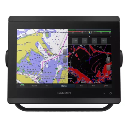
Garmin GPSMAP 8412 Chartplotter
$2,000.00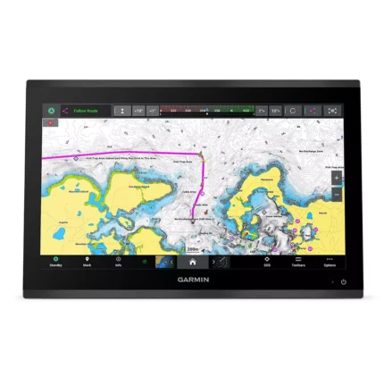
Garmin GPSMAP 9019 Chartplotter
$7,143.00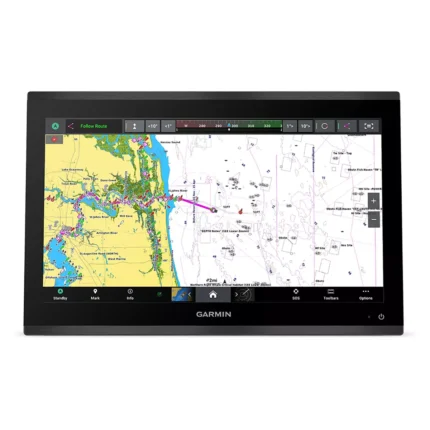
Garmin GPSMAP 9219 Chartplotter
$6,629.00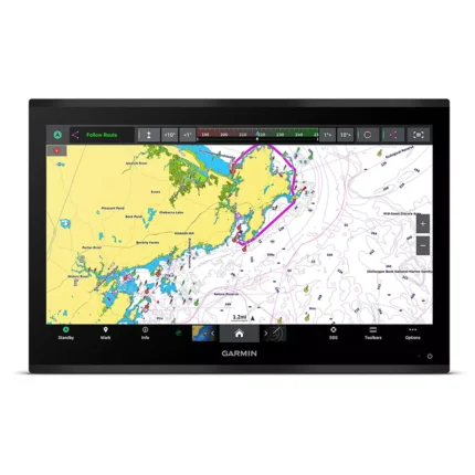
Garmin GPSMAP 9224 Chartplotter
$8,904.00
Raymarine Axiom+ 7 Chartplotter
$475.00
SI-TEX SVS-760C Chartplotter
$396.00
Reviews
There are no reviews yet.