


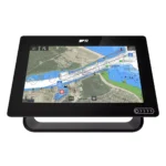
Garmin GPSMAP 9022 Chartplotter
$7,539.00
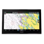
Garmin GPSMAP 9022 Chartplotter is a chartplotter built for integrated helm use, combining 21.5″ Diagonal (18.7″ x 10.5″), 4K IPS Touchscreen (Sunlight Readable), 7x Faster Processing Power, and Garmin BlueNet (Gigabit Speeds) for navigation, chart control, and connected onboard systems.
Overview Garmin GPSMAP 9022 Chartplotter
Garmin GPSMAP 9022 Chartplotter is a chartplotter built for navigation, chart management, and integration with compatible onboard electronics. Key specifications include 21.5" Diagonal (18.7" x 10.5"), 4K IPS Touchscreen (Sunlight Readable), 7x Faster Processing Power, and Garmin BlueNet (Gigabit Speeds).
It is well suited to offshore navigation, deep-water use, and large-vessel helm installations where captains need a responsive display for route planning, split-screen viewing, and connected sensors. Features such as 22-Inch 4K IPS Display and Superior Processing Speed help support visibility, system control, and everyday helm operation.
Key Features
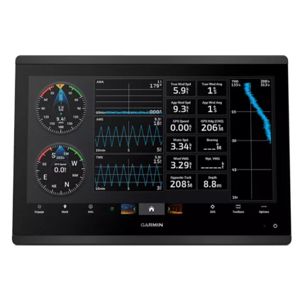
- 22-Inch 4K IPS Display: Experience a "4K Paradise" on the water with a massive 3840 x 2160 pixel resolution. The IPS (In-Plane Switching) technology ensures vibrant colors and clear readouts from any viewing angle, even in direct, harsh sunlight.
- Superior Processing Speed: Processing power is 7 times faster than its predecessors, allowing you to draw high-definition charts instantly and calculate Auto Guidance+ routes with high speed. This ensure the interface remains fluid and responsive during critical maneuvers.
- Garmin BlueNet Gigabit Networking: Future-proof your vessel with networking speeds up to 10 times faster than older standards. BlueNet allows for the seamless integration of multiple chartplotters, high-definition cameras, and high-frequency radars with minimal latency.
- Video and Entertainment Integration: Featuring HDCP distribution and HDMI ports, the unit allows you to stream audio and video throughout your vessel's network. Monitor surveillance cameras or enjoy high-definition entertainment across all connected screens and speakers.
- Precision GPS 24xd Position Receiver: The included high-accuracy 10 Hz receiver supports multi-band, multi-constellation GPS (GPS, GLONASS, GALILEO, BEIDOU), providing ultra-smooth vessel tracking and fluid movement on your 4K charts.
Applications
Garmin GPSMAP 9022 Chartplotter is suitable for use on offshore navigation, deep-water use, and large-vessel helm installations where a central display is needed for charts, route planning, and connected onboard data. Its 21.5" Diagonal (18.7" x 10.5") screen and Garmin BlueNet (Gigabit Speeds) support day-to-day navigation together with radar, sonar, video, or NMEA network integration where applicable.
It also fits refit and upgrade projects where captains want a cleaner helm layout without giving up system visibility. Features such as 22-Inch 4K IPS Display and Superior Processing Speed help keep chart data and connected functions accessible during coastal passages, offshore runs, and routine maneuvering.
Specifications
| Display Size | 21.5" Diagonal (18.7" x 10.5") |
| Display Type | 4K IPS Touchscreen (Sunlight Readable) |
| Resolution | 3840 x 2160 pixels |
| Processor | 7x Faster Processing Power |
| Networking | Garmin BlueNet (Gigabit Speeds) |
| GPS Receiver | Included GPS 24xd (10 Hz Receiver) |
| Internal Memory | 5,000 Waypoints / 100 Routes |
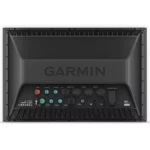
| Video Interface | 2x HDMI In (HDCP), 1x HDMI Out, 1x BNC In |
| Waterproof Rating | IPX7 Standards |
| Product Warranty | Limited Manufacturer Warranty Included |
What’s Included
- 1x Garmin GPSMAP 9022 22-inch 4K Chartplotter
- 1x Trim Snap Cover and Protective Cover
- 1x Flush Mount Hardware Kit
- 1x Power Cable
- 1x GPS 24xd NMEA 2000 (with pole, flush, and under deck adapters)
- 1x NMEA 2000 Backbone/Drop Cable (2 meters)
- 1x NMEA 2000 Power Cable & T-Connector Kit
- 1x Comprehensive Documentation Pack
Frequently Asked Questions About Garmin GPSMAP 9022 Chartplotter
What does the Garmin GPSMAP 9022 Chartplotter offer for everyday navigation?
Garmin GPSMAP 9022 Chartplotter is built to serve as a dedicated chartplotter for everyday helm navigation. With its 22-Inch display with 3840 x 2160 pixels and stated performance and integration features, it is positioned for chart handling, route work, and practical use within a connected marine setup.
What is the screen experience like in daily use?
This chartplotter uses a 22-Inch display with 3840 x 2160 pixels and touchscreen interface to make chart browsing, menu access, and route adjustments more direct at the helm. The processing platform is described to keep chart browsing and menu response responsive at the helm.
How does this chartplotter integrate with other onboard electronics?
This chartplotter is intended to work within a broader electronics layout by supporting Garmin BlueNet and NMEA 2000, camera input support, and radar connectivity where stated. This gives the display a stronger role as a central charting screen when other sensors or onboard data also need to be viewed at the helm.
Where does this unit make the most sense on board?
This chartplotter is most relevant for cruising boats and connected helms who need a dependable navigation screen at the helm. It also helps the unit remain practical for routine route checks and day-to-day helm operation.
Related products
Garmin GPSMAP 1623 Chartplotter
$3,184.00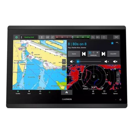
Garmin GPSMAP 1643 Chartplotter
$3,054.00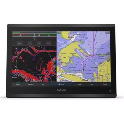
Garmin GPSMAP 8416 Chartplotter
$3,082.00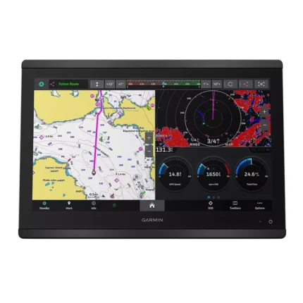
Garmin GPSMAP 8616 Chartplotter
$3,136.00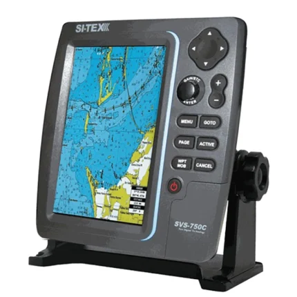
SI-TEX SVS-750C Chartplotter
$351.00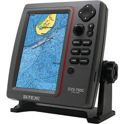
SI-TEX SVS-760C Chartplotter
$396.00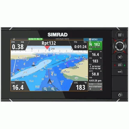
Simrad NSS7m evo2 Chartplotter
$539.00
Reviews
There are no reviews yet.