
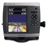
Garmin GPSMAP 536 Inland Chartplotter
$324.00
Garmin GPSMAP 536 Inland Chartplotter is a 5-inch freshwater chartplotter with preloaded U.S. inland maps, high-sensitivity GPS, and NMEA 2000 connectivity.
Overview Garmin GPSMAP 536 Inland Chartplotter
Garmin GPSMAP 536 Inland Chartplotter is tuned for inland water navigation rather than coastal mapping. It uses a bright 5-inch VGA display, a high-speed internal processor, and preloaded coverage for more than 14,000 U.S. lakes and rivers to support freshwater boaters and anglers.
The unit is aimed at skippers who need responsive chart handling in rivers, reservoirs, and inland lakes. A high-sensitivity internal GPS receiver and NMEA 2000 and NMEA 0183 support make it suitable as either a primary inland chartplotter or a dedicated freshwater navigation screen.
Key Features
- Preloaded inland mapping: Covers more than 14,000 U.S. lakes and navigable rivers for freshwater navigation.
- 5-inch VGA display: The 480 x 640 screen remains readable in bright conditions.
- High-speed processor: Keeps redraws and panning responsive while navigating narrow channels or lake contours.
- High-sensitivity internal GPS: Supports stable vessel positioning for inland route work.
- NMEA 2000 and NMEA 0183 support: Helps integrate the chartplotter into compatible onboard systems.
Applications
Best suited to freshwater anglers, inland cruisers, and river boat operators who want dedicated mapping for domestic lakes and rivers. The preloaded map coverage makes it especially practical for boats that stay primarily on inland waters.
It is also useful where a compact chartplotter is needed for a secondary station or a smaller freshwater helm.
Specifications
| Product type | Inland chartplotter |
| Display | 5.0-inch diagonal, 480 x 640 pixels (VGA) |
| Brightness | Over 800 nits, sunlight readable |
| GPS | High-sensitivity internal GPS receiver |
| Networking | NMEA 2000 certified and NMEA 0183 with 2 ports |
| Mapping | Preloaded U.S. inland waters coverage for 14,000+ lakes and rivers |
What’s Included
- Garmin GPSMAP 536 chartplotter unit
- Tilt/swivel mount with quick release
- Protective front sun cover
- Power/data cable
- Flush mount gasket and hardware
- Documentation and user manual pack
Frequently Asked Questions About Garmin GPSMAP 536 Inland Chartplotter
What does the Garmin GPSMAP 536 Inland Chartplotter offer for everyday navigation?
Garmin GPSMAP 536 Inland Chartplotter is intended for boaters who spend most of their time on inland waters instead of coastal routes. The combination of a 5-inch display with 480 x 640 pixels (VGA), high-sensitivity GPS, and broad freshwater map coverage makes it especially practical for lakes, rivers, and reservoir navigation.
Why is this chartplotter well suited to inland waters?
This chartplotter focuses on inland use with coverage for lakes, rivers, and reservoirs instead of general coastal mapping. The 5-inch display with 480 x 640 pixels (VGA) and responsive processor help when navigating narrow channels, contour-heavy areas, and smaller freshwater helm stations.
Can this display share data within an onboard system?
This chartplotter includes a high-sensitivity internal GPS for stable positioning and supports both NMEA 2000 and NMEA 0183 for system integration. That makes it easier to use the display as either a stand-alone inland navigator or part of a broader electronics setup.
Where does this display fit best in everyday boating?
This chartplotter is aimed primarily at cruisers, anglers, and freshwater boaters who spend most of their time on domestic lakes, rivers, and reservoirs. Because the mapping focus is inland rather than general offshore coverage, it fits best on boats that want dedicated freshwater route support.
Related products
Garmin GPSMAP 1022 Chartplotter
$909.00
Garmin GPSMAP 1223 Chartplotter
$1,884.00
Garmin GPSMAP 1623 Chartplotter
$3,184.00
Garmin GPSMAP 1643 Chartplotter
$3,054.00
Garmin GPSMAP 8412 Chartplotter
$2,000.00
Garmin GPSMAP 9022 Chartplotter
$7,539.00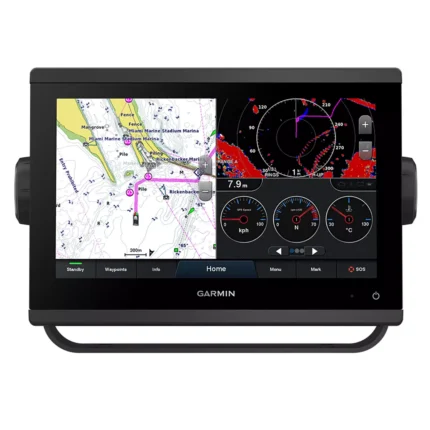
Garmin GPSMAP 923 Chartplotter
$974.00
Reviews
There are no reviews yet.