
Garmin GPSMAP 3210 Network Chartplotter
$576.00
Garmin GPSMAP 3210 Network Chartplotter is a large-format Garmin chartplotter with preloaded U.S. coastal BlueChart g2 mapping. It is designed for plug-and-play helm use while still supporting Garmin Marine Network expansion, video input, and optional weather, radar, and sonar integration.
Overview Garmin GPSMAP 3210 Network Chartplotter
Garmin GPSMAP 3210 Network Chartplotter is built for boaters who want a big-screen chartplotter with preloaded U.S. coastal coverage and straightforward helm operation. The 10.4-inch display is paired with BlueChart g2 mapping for the U.S. coast, Alaska and Hawaii, with smoother chart layering and both 2D and 3D viewing options.
The unit can operate on its own or as part of a Garmin Marine Network with additional displays and sensors. Two video inputs, optional XM weather, radar and sonar support, and a WAAS-enabled GPS 17 sensor make it a practical choice for larger helms that want charting as the main priority but still need room to expand.
Key Features
- Large 10.4-inch display: The big-screen format supports easier chart reading from normal helm viewing distance.
- Preloaded coastal charting: BlueChart g2 coverage for U.S. coastal waters, Alaska and Hawaii gives the unit strong ready-to-use navigation data.
- 2D and 3D chart views: Mariner's Eye and direct-overhead views help match chart presentation to operator preference.
- Network expandability: The unit can integrate with other Garmin displays and optional weather, radar and sonar devices.
- Video monitoring support: Two video inputs allow additional onboard areas to be viewed from the helm display.
- Quick-access controls: Assignable soft keys help keep commonly used functions close at hand.
Applications
- Main chartplotter duty on larger coastal boats that need a bigger screen.
- Garmin helms planning to add weather, radar or sonar devices later.
- Installations that want both navigation display and occasional video monitoring.
Specifications
| Display | 10.4-inch diagonal display |
| Chart data | Preloaded U.S. coastal marine maps including Alaska and Hawaii with BlueChart g2 technology |
| View options | 3D Mariner's Eye and 2D direct-overhead chart views |
| Networking | Garmin Marine Network compatible |
| Video | Accepts up to 2 video inputs |
| GPS | WAAS-enabled GPS 17 sensor |
| Control features | Assignable soft keys |
What’s Included
- GPSMAP 3210
- Preloaded U.S. marine detailed maps (g2 technology)
- GPS 17 WAAS-enabled sensor
- Power/data cable
- Bail mount
- Protective cover
- Template for flush mounting
- Owner’s manual
- Quick reference guide
- Installation guide
Frequently Asked Questions About Garmin GPSMAP 3210 Network Chartplotter
What is the Garmin GPSMAP 3210 Network Chartplotter designed for?
Garmin GPSMAP 3210 Network Chartplotter is built to serve as a dedicated chartplotter for everyday helm navigation. With its 10.4-inch display, preloaded BlueChart g2 cartography, and stated performance features, it is positioned for chart handling, route work, and practical use within a connected marine setup.
How does the display support chart viewing at the helm?
This chartplotter centers navigation around a 10.4-inch display that gives chart data enough working space without overcomplicating operation. The processing platform is described to keep chart browsing and menu response responsive at the helm.
What networking support does this unit provide?
This chartplotter supports Garmin Marine Network, camera input support, and radar connectivity where stated, which helps it exchange navigation data and serve as part of a broader helm installation. That is useful when charting needs to sit alongside vessel data, shared maps, or connected marine sensors on the same system.
Who is this display most relevant for?
This chartplotter makes the most sense for cruising boats and general navigation helms that want a chartplotter focused on route work, visibility, and helm integration. Its preloaded BlueChart g2 cartography also helps reduce setup time for boats that want charting ready from the start.
Related products
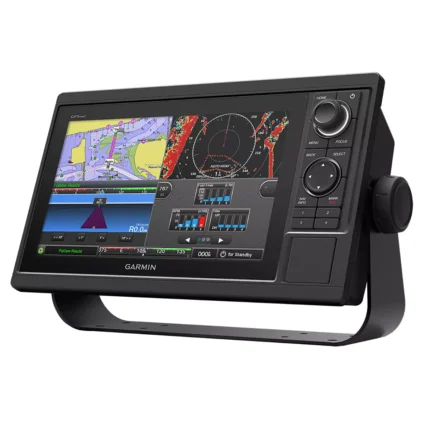
Garmin GPSMAP 1022 Chartplotter
$909.00
Garmin GPSMAP 1623 Chartplotter
$3,184.00
Garmin GPSMAP 1643 Chartplotter
$3,054.00
Garmin GPSMAP 8410 Chartplotter
$1,513.00
Garmin GPSMAP 9022 Chartplotter
$7,539.00
Raymarine Axiom+ 7 Chartplotter
$475.00
Reviews
There are no reviews yet.