
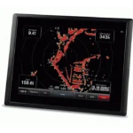
Garmin GPSMAP 5208 Touchscreen Chartplotter
$1,079.00
Garmin GPSMAP 5208 Touchscreen Chartplotter is an 8.4-inch network chartplotter with preloaded BlueChart g2 coastal cartography and support for radar, sonar, and XM weather integration.
Overview Garmin GPSMAP 5208 Touchscreen Chartplotter
Garmin GPSMAP 5208 Touchscreen Chartplotter is designed as a central helm display for the Garmin Marine Network. It combines an 8.4-inch VGA touchscreen with preloaded BlueChart g2 coastal cartography for the United States, including Alaska, Hawaii, and the Bahamas.
This model is built for networked navigation rather than stand-alone chart viewing only. It can be expanded with optional sonar, radar, and satellite weather, while BlueChart g2 Vision support adds 3D views, aerial reference photos, and Auto Guidance for more detailed route planning.
Key Features
- 8.4-inch VGA touchscreen: Large touch control makes chart viewing and menu access easier at the helm.
- Preloaded BlueChart g2 mapping: Coastal U.S. coverage includes detailed coastlines, depth contours, navaids, port plans, tide data, and Bahamas Explorer charts.
- Garmin Marine Network support: The unit can be integrated with optional GSD 22 sonar, Garmin radar, and GDL 30 or GDL 30A weather receivers.
- WAAS-enabled GPS sensor: An included GPS 17 antenna supports reliable vessel positioning for route tracking and chart work.
- BlueChart g2 Vision compatibility: Optional mapping cards add satellite imagery, aerial photos, Mariner’s Eye, Fish Eye, and Auto Guidance features.
Applications
Well suited to cruising boats and sportfishing vessels that need a dedicated chartplotter at the center of a Garmin network. The display is useful for route planning, coastline navigation, and monitoring optional weather overlays from the helm.
It also fits installations where onboard sensors and marine electronics are being combined into one charting interface with room for future expansion.
Specifications
| Product type | Touchscreen network chartplotter |
| Display | 8.4-inch VGA screen |
| Mapping | Preloaded BlueChart g2 coastal United States coverage including Alaska, Hawaii, and the Bahamas |
| GPS | WAAS-enabled 12 parallel channel GPS sensor with included GPS 17 antenna |
| Expansion | Optional BlueChart g2 Vision SD cards |
| Network support | Optional sonar, radar, and XM weather/radio integration |
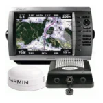
What’s Included
- GPSMAP 5208
- Bail mount and knobs
- GPS 17 antenna
- Protective front cover
- Power cable
- Video cable
- NMEA 0183 cable
- NMEA 2000 cable
- Flush mount hardware
- In-line fuse kit for GPS 17
- Marine grommet kit
- Crimp connectors
- Owner’s manual
- Installation instructions
- Quick reference guide
Frequently Asked Questions About Garmin GPSMAP 5208 Touchscreen Chartplotter
What is the Garmin GPSMAP 5208 Touchscreen Chartplotter designed for?
Garmin GPSMAP 5208 Touchscreen Chartplotter is built to serve as a dedicated chartplotter for everyday helm navigation. With its 8.4-inch VGA display, preloaded BlueChart g2 coverage for the USA and Bahamas, and stated performance features, it is positioned for chart handling, route work, and practical use within a connected marine setup.
What is the screen experience like in daily use?
The 8.4-inch VGA display gives this chartplotter a clear working area for charts and menu control at the helm. Its touchscreen layout keeps route changes more direct, while the processing platform is described to keep chart browsing and menu response responsive at the helm.
How does this chartplotter integrate with other onboard electronics?
This chartplotter supports Garmin Marine Network, NMEA 2000, and NMEA 0183 and radar connectivity where stated, which helps it exchange navigation data and serve as part of a broader helm installation. That is useful when charting needs to sit alongside vessel data, shared maps, or connected marine sensors on the same system.
Who is this display most relevant for?
This chartplotter is most relevant for sportfishing boats who need a dependable navigation screen at the helm. Its preloaded BlueChart g2 coverage for the USA and Bahamas also helps reduce setup time for boats that want charting ready from the start.
Related products
Garmin GPSMAP 1243 Chartplotter
$1,754.00
Garmin GPSMAP 1623 Chartplotter
$3,184.00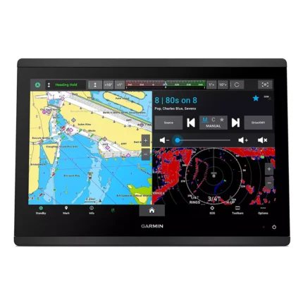
Garmin GPSMAP 1643 Chartplotter
$3,054.00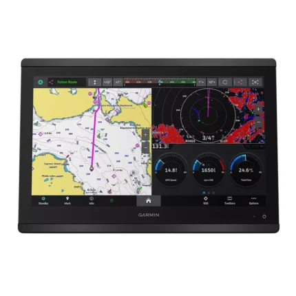
Garmin GPSMAP 8616 Chartplotter
$3,136.00
Garmin GPSMAP 9022 Chartplotter
$7,539.00
Garmin GPSMAP 9027 Chartplotter
$10,199.00
Reviews
There are no reviews yet.