
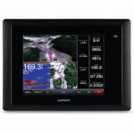
Garmin GPSMAP 820 Chartplotter
$630.00
Garmin GPSMAP 820 Chartplotter is a dedicated marine chartplotter with an 8-inch display for clear route planning and helm visibility. It pairs fast positioning with network connectivity for radar integration and everyday coastal or offshore navigation.
Overview Garmin GPSMAP 820 Chartplotter
Garmin GPSMAP 820 Chartplotter is a dedicated marine chartplotter built around an 8-inch display for dependable route planning and helm visibility. The 800 x 600 Pixels (SVGA) screen keeps charts, waypoints, and route information easy to read in everyday use.
It combines 10 Hz High-Sensitivity GPS/GLONASS with Worldwide Basemap and NMEA 2000, NMEA 0183, Garmin Marine Network so the unit can serve as a practical navigation hub for coastal cruising, sailing, or fishing boats. The keyed interface also remains easy to manage when conditions are wet or the boat is moving hard.
Key Features
- Display clarity: Uses an 8-inch display with 800 x 600 Pixels (SVGA) so sonar, charts, and system data remain easier to read from the helm.
- Positioning: 10 Hz High-Sensitivity GPS/GLONASS keeps chart position and waypoint updates responsive for navigation and return-to-spot accuracy.
- Chart support: Worldwide Basemap supports route planning and local detail without forcing a generic navigation setup.
- System integration: NMEA 2000, NMEA 0183, Garmin Marine Network allows the unit to share data with compatible marine electronics and sensors.
- Wireless support: Wi-Fi (BlueChart Mobile Compatible) expands access to compatible mobile or remote helm functions where supported.
- Radar compatibility: Supports All Garmin Marine Radars for stronger situational awareness in reduced visibility or busy waterways.
Applications
This chartplotter suits powerboats, sailboats, and fishing vessels that prioritize dependable navigation with tactile control at the helm. The keyed interface is practical in wet conditions or rough water where precise button input can be easier than touchscreen operation.
It is a strong option for coastal passage making, everyday route planning, and adding radar support to a navigation-focused console without moving into a full sonar combo package.
Specifications
| Display Size | 8.0 Inches (Diagonal) |
| Display Resolution | 800 x 600 Pixels (SVGA) |
| GPS Receiver | 10 Hz High-Sensitivity GPS/GLONASS |
| Networking | NMEA 2000, NMEA 0183, Garmin Marine Network |
| Wireless Support | Wi-Fi (BlueChart Mobile Compatible) |
| Card Slots | 2 SD |
| Preloaded Maps | Worldwide Basemap |
| Waterproof Rating | IPX7 (Waterproof) |
| Mounting Options | Bail, Flush, or Flat |
| Radar Compatibility | Supports All Garmin Marine Radars |
| Product Warranty | Garmin Standard Marine Warranty |
What’s Included
- Garmin GPSMAP 820 with worldwide basemap
- Power/data cable
- Bail mount kit
- Flush mount kit
- Protective front cover
- Documentation and manuals
Frequently Asked Questions About Garmin GPSMAP 820 Chartplotter
Who is the Garmin GPSMAP 820 Chartplotter intended for on board?
Garmin GPSMAP 820 Chartplotter is designed as a helm navigation display for mariners who need clear chart viewing and reliable onboard integration. The 8-inch display with 800 x 600 Pixels (SVGA) and stated processing platform support route planning and day-to-day navigation while keeping chart work responsive at the helm.
How does this display support quick chart interaction?
The 8-inch display with 800 x 600 Pixels (SVGA) gives this chartplotter a clear working area for charts and menu control at the helm. Its touchscreen layout keeps route changes more direct, while the processing platform is described to keep chart browsing and menu response responsive at the helm.
Can this display work as part of a wider helm system?
This chartplotter is intended to work within a broader electronics layout by supporting Garmin Marine Network, NMEA 2000, and NMEA 0183 and radar connectivity where stated. This gives the display a stronger role as a central charting screen when other sensors or onboard data also need to be viewed at the helm.
Who is this display most relevant for?
This chartplotter makes the most sense for cruising boats and connected helms that want a chartplotter focused on route work, visibility, and helm integration. This keeps the product focused on navigation tasks rather than unnecessary extra complexity.
Related products
Garmin GPSMAP 1022 Chartplotter
$909.00
Garmin GPSMAP 1243 Chartplotter
$1,754.00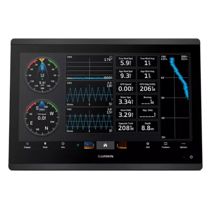
Garmin GPSMAP 1623 Chartplotter
$3,184.00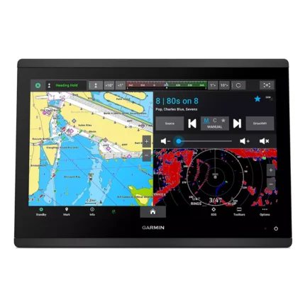
Garmin GPSMAP 1643 Chartplotter
$3,054.00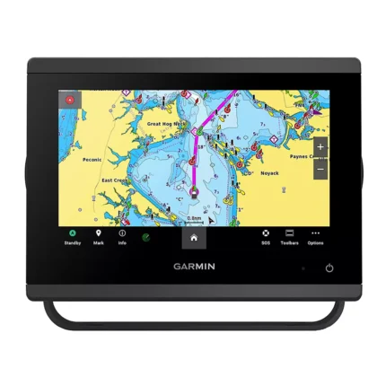
Garmin GPSMAP 743 Chartplotter
$640.00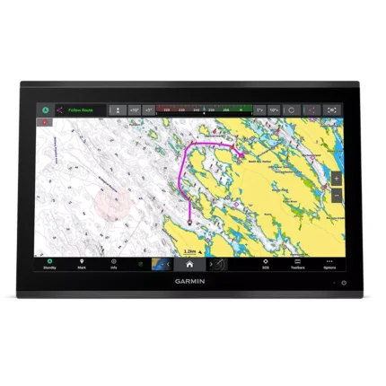
Garmin GPSMAP 9022 Chartplotter
$7,539.00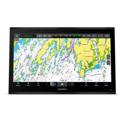
Garmin GPSMAP 9024 Chartplotter
$8,839.00
Reviews
There are no reviews yet.